
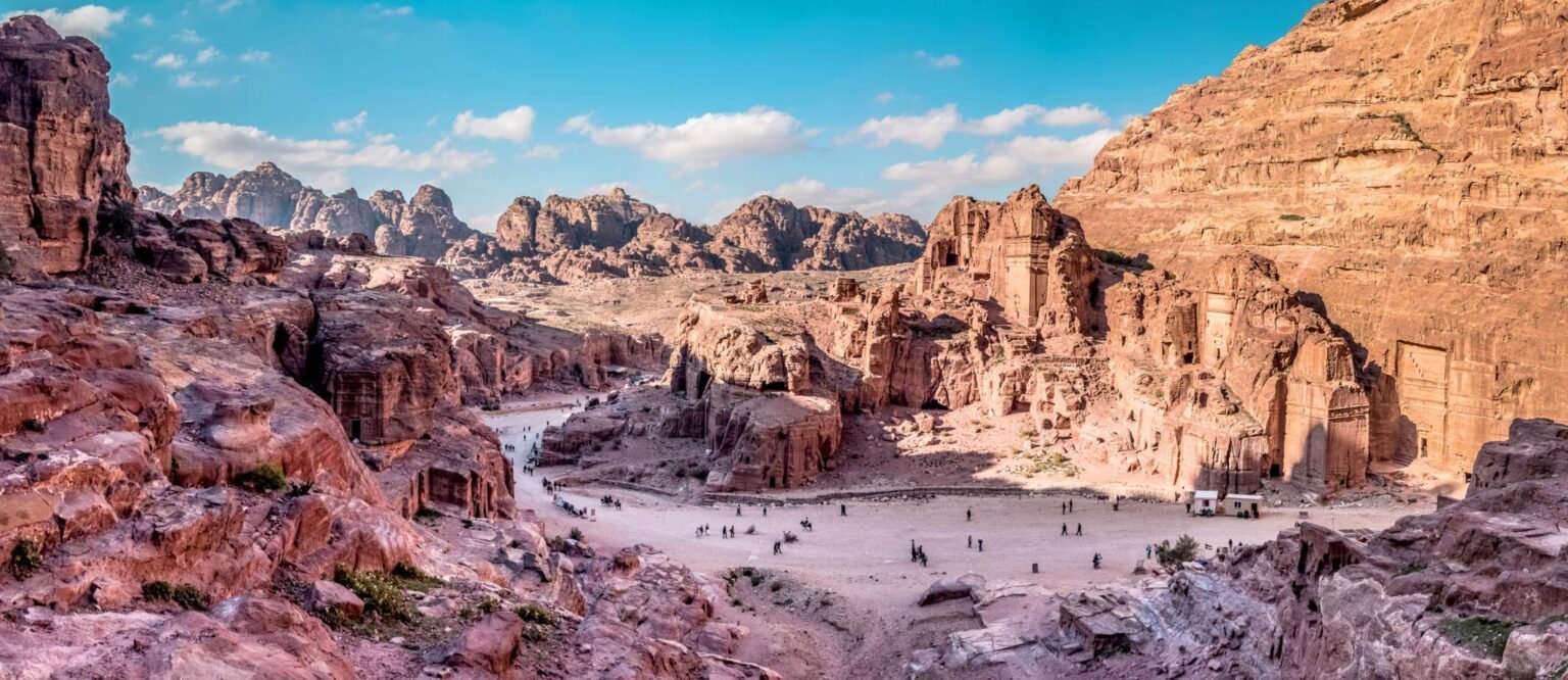
Local families have lived beside Petra for generations, and we, the locals who guide here, have walked its paths with travellers from every corner of the world. Every time we see the same moment: the end of the Siq, the first glimpse of the Treasury, and a face that changes completely. This map is our way of walking with you before you arrive.
Tap a number on the map, or a card below, to read about each place as we would tell it to you on the trail.
 Visitor Centre & the road to the SiqLearn more
 The SiqLearn more
 The Treasury (Al-Khazneh)Learn more
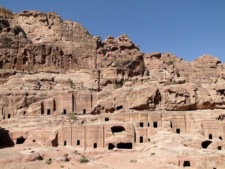 Street of FaçadesLearn more
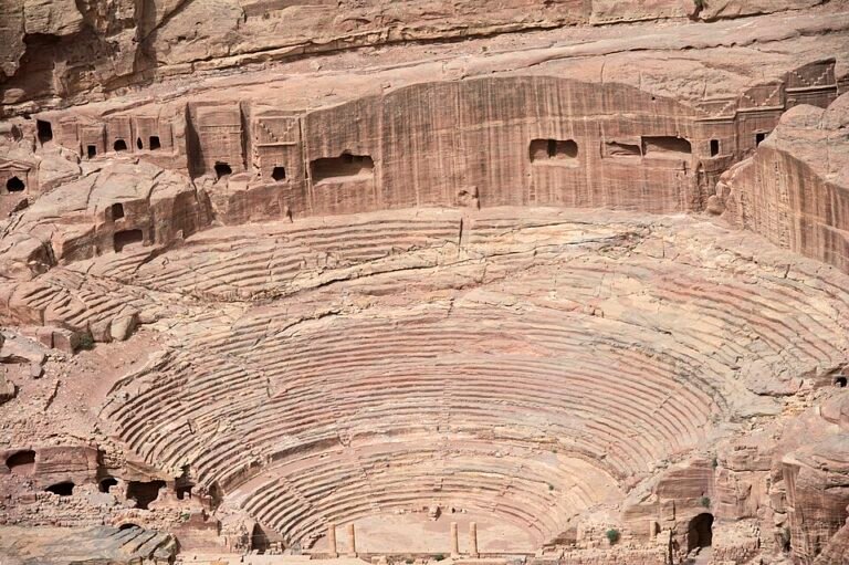 The TheatreLearn more
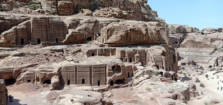 The Royal TombsLearn more
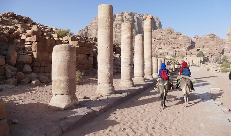 The Colonnaded StreetLearn more
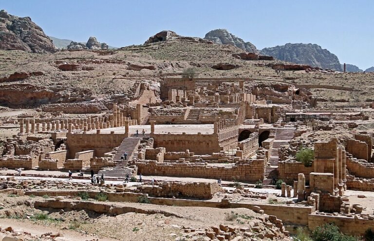 The Great TempleLearn more
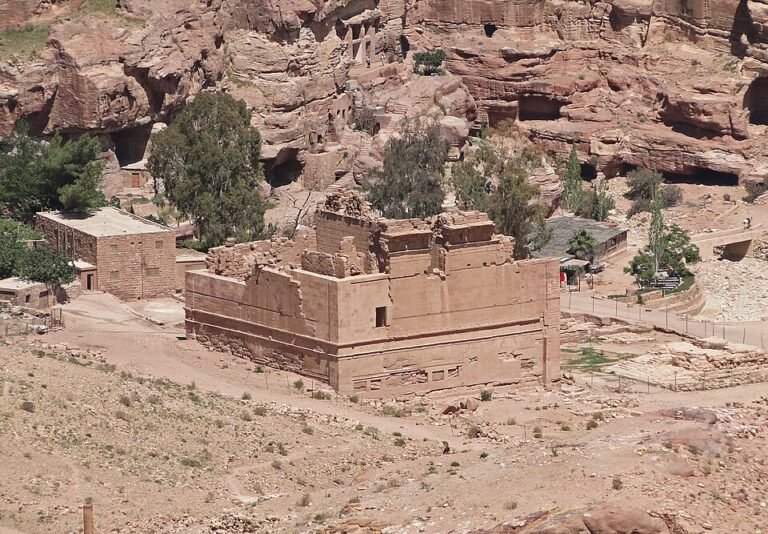 Qasr al-BintLearn more
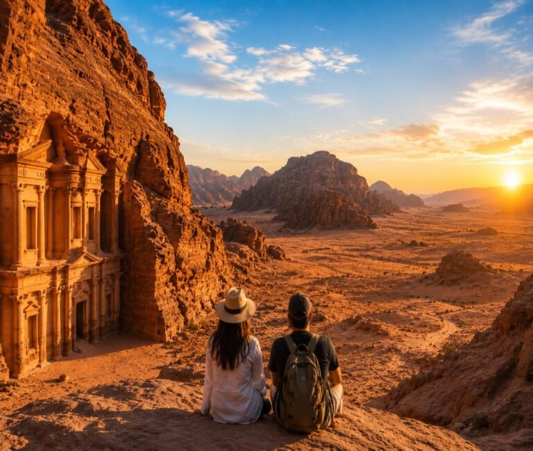 The Monastery (Ad-Deir)Learn more
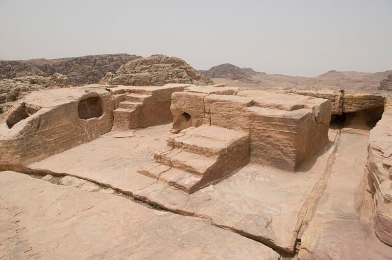 The High Place of SacrificeLearn more
 Wadi FarasaLearn more
 Little Petra (Siq al-Barid)Learn more
The Petra Map
View large map ↗
Point at a number to see the name; click it to jump to the story. On a phone, swipe the map sideways.
Visitor Centre & the road to the Siq
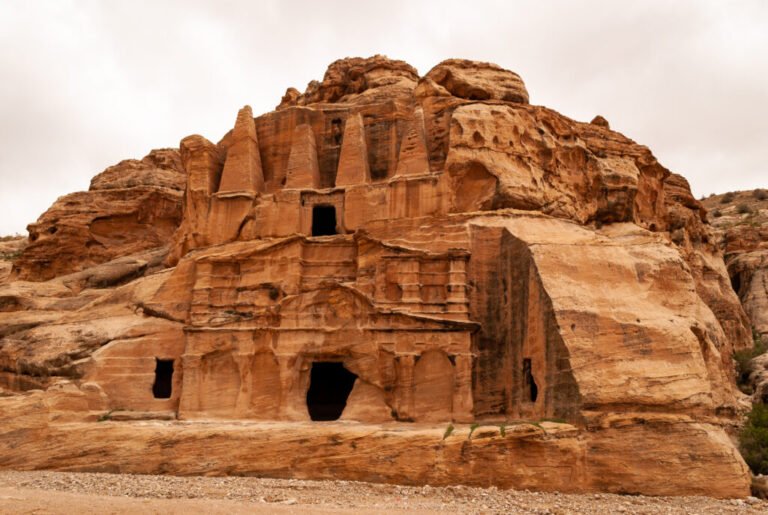
Every visit to Petra begins here, at the edge of Wadi Musa, the town where many of us grew up. This is where you buy your ticket or show your Jordan Pass, fill your water bottle and use the last proper facilities for a while.
From the gate, a wide sandy path runs about 800 metres down to the entrance of the Siq. On the way you pass the Djinn Blocks, great square towers of stone that the Nabataeans may have built for their dead, and the Obelisk Tomb carved into the cliff on your left. Horses wait here for anyone who would rather ride this first stretch.
Our advice is simple: come at opening time. The light is soft, the path is quiet, and you reach the Treasury before the crowds.
↑ Back to the mapThe Siq
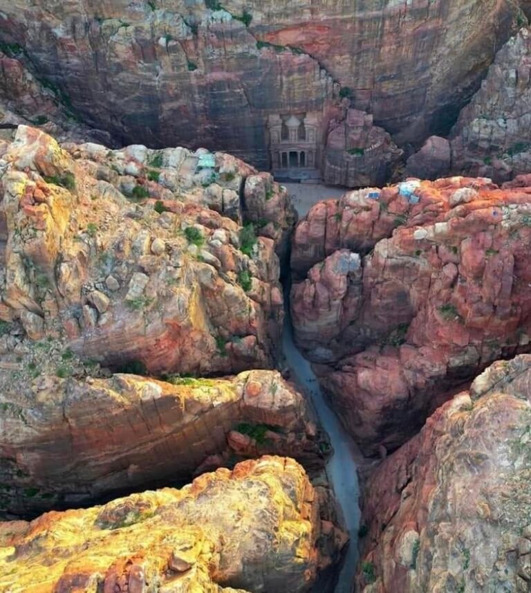
The Siq is a narrow crack in the mountain about 1.2 kilometres long, and it is the way the Nabataeans themselves walked into their capital. The walls rise high above you and in places come so close that you can almost touch both sides.
Look down along the walls and you will find the water channels the Nabataeans cut to carry spring water into the city, and stretches of the old paved road. Further in there is a worn carving of a camel caravan with its merchants, life-size, walking the same way you are.
We have walked the Siq more times than we can count, and we still slow down near the end, because we know what is waiting.
↑ Back to the mapThe Treasury (Al-Khazneh)
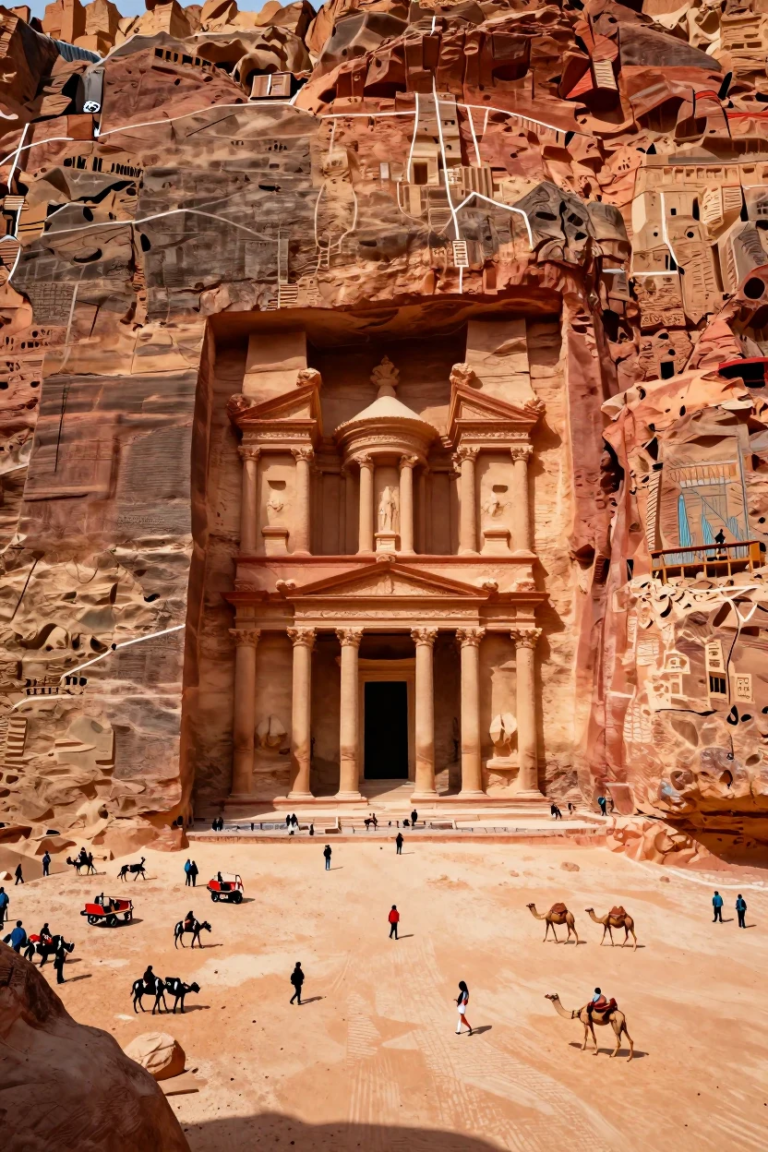
At the end of the Siq the rock opens and the Treasury appears, about forty metres of columns, statues and carved stone, glowing pink and orange. Nothing prepares you for that first glimpse.
It was most likely built as a royal tomb in the first century AD. The name comes from a Bedouin story that pirates or a pharaoh hid treasure in the stone urn at the top; you can still see the bullet marks where people shot at it hoping it would break open.
Come in the morning, when the sun reaches the façade. Then step back to the far side of the square and look up: the details are finer than any photo shows.
↑ Back to the mapStreet of Façades
After the Treasury the valley widens into what we call the Outer Siq, and the cliffs on both sides are lined with tombs, one after another. This is the Street of Façades.
Many of the tombs are crowned with rows of stepped carvings, a style the Nabataeans brought from far to the north and east. Most are simple compared with the Treasury, which tells you these were the tombs of ordinary families, not kings.
Walk slowly here and look up: some tombs sit high on the cliff, and you can still see the stairs cut to reach them.
↑ Back to the mapThe Theatre
The Theatre is carved straight out of the mountain. The Nabataeans built it, and it was enlarged after the Romans took over the kingdom in AD 106.
Look at the back wall above the top rows of seats. You will see the openings of older tombs that were cut through when the theatre was made bigger, which shows how much the city grew.
It is a good place to sit for a few minutes, out of the busy path, and imagine the whole hillside full of people.
↑ Back to the mapThe Royal Tombs
On the face of Jebel al-Khubtha stand the grandest tombs in Petra: the Urn Tomb, the Silk Tomb, the Corinthian Tomb and the Palace Tomb. Together we call them the Royal Tombs.
The Urn Tomb has a great courtyard and vaulted chambers below, and centuries later it was turned into a church. The Silk Tomb is famous for the bands of red, yellow and white in its rock. The Palace Tomb is the largest, several storeys high.
Climb the steps to the Urn Tomb in the late afternoon. The sun lights the whole cliff, and you get one of the best views back over the city centre.
↑ Back to the mapThe Colonnaded Street
This was the main street of Petra, paved and lined with columns, with shops, markets and fountains along both sides. Walking it today you are on the same stones people walked two thousand years ago.
At its eastern end stood a great public fountain, the Nymphaeum. At the western end a monumental gate led into the sacred area of Qasr al-Bint.
This is the flattest part of the site and a good place to rest in the shade. Camels and donkeys wait here too, if your legs need a break.
↑ Back to the mapThe Great Temple
Above the south side of the Colonnaded Street rise the remains of one of the largest buildings in Petra, the Great Temple. It was buried under sand and rubble until archaeologists from Brown University began excavating it in the 1990s.
Climb up and you will find broad courtyards, rows of columns and, inside, a small theatre-like hall where people may have met. Part of it is still being studied, and we still argue about what it was used for.
Few visitors climb up here, so it is often quiet, with a wide view of the city.
↑ Back to the mapQasr al-Bint
Qasr al-Bint stands at the end of the Colonnaded Street. It is one of the few buildings in Petra that was built, stone by stone, rather than carved from the rock, and it was the main temple of the Nabataean city.
Its name means the Palace of the Pharaoh’s Daughter, from a local legend, but it was most likely dedicated to Dushara, the chief god of the Nabataeans. In front of it you can still see the great altar.
From here, the path to the Monastery begins. Fill your water before you start the climb.
↑ Back to the mapThe Monastery (Ad-Deir)
High above the city, at the end of a climb of 873 rock-cut steps, stands the Monastery, almost fifty metres high and even bigger than the Treasury. It was probably a place of gathering and worship; the name comes from crosses carved inside in later times.
The climb takes most people 45 to 60 minutes. Donkeys and mules can carry you up from near Qasr al-Bint if you prefer. Go slowly, stop often, and turn around: the views back over the mountains are part of the reward.
Try to be there in the late afternoon. Sit on the rocks opposite with a glass of tea from the little café and watch the façade turn gold. Then walk a few minutes further to the viewpoints over Wadi Araba.
↑ Back to the map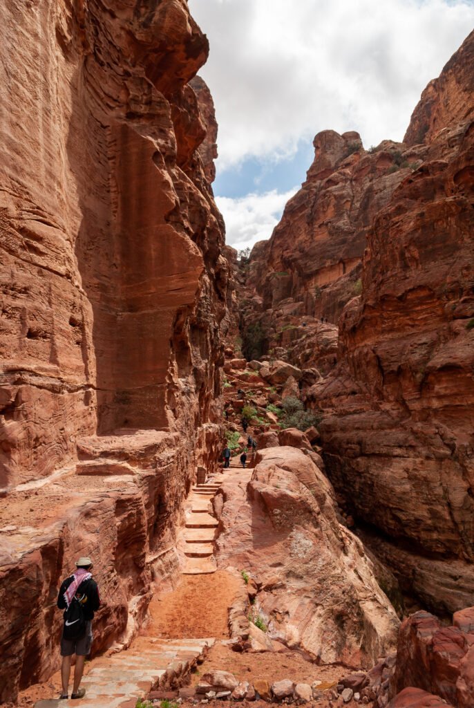
The High Place of Sacrifice
Just before the Theatre, a long staircase climbs up Jebel al-Madhbah to the High Place of Sacrifice, a flat summit where the Nabataeans held ceremonies at an altar cut into the rock.
On the way up you pass two tall obelisks carved from the mountain itself. At the top the whole city lies below you, and you understand for the first time how Petra fits into the mountains.
It is a steep climb with no shade, so go early in the day. Rather than coming back the same way, continue down the other side into Wadi Farasa.
↑ Back to the mapWadi Farasa
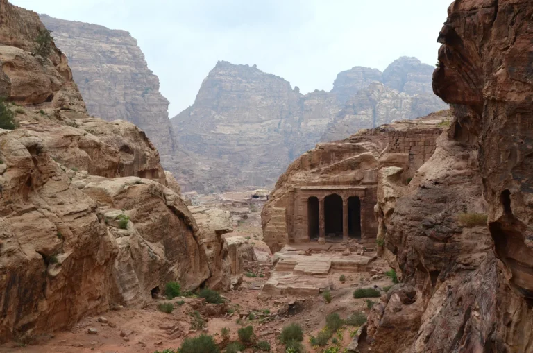
Coming down from the High Place, the path drops into Wadi Farasa, one of the quietest corners of Petra. Here you find the Lion Fountain, a lion carved in the rock where water once ran, and the Garden Temple with its columns.
Further down are the Roman Soldier Tomb, named for the statue of a man in armour on its façade, and, facing it, a banqueting hall carved into the rock with coloured stone walls.
The path brings you back to the city centre near Qasr al-Bint, so you can make a full loop without walking the main trail twice.
↑ Back to the mapLittle Petra (Siq al-Barid)
About fifteen minutes north of Wadi Musa by road lies Little Petra, Siq al-Barid, the cold canyon. It was a small Nabataean suburb where caravans may have stopped on their way to the city.
The canyon is short, with houses, cisterns and stairways carved into its walls. Climb into the Painted House and look up: on the ceiling you can still see paintings of vines, flowers and birds, among the very few Nabataean paintings that survive.
It is far quieter than Petra, and we love bringing guests here at the end of the day.
↑ Back to the mapGetting around Petra
Most of Petra is walked. From the Visitor Centre to Qasr al-Bint is about 4 km each way. If you need help with the distance, these rides are available:
| Ride | Route | Distance | Price |
|---|---|---|---|
| Horse ride | Visitor Centre → the Dam at the Siq entrance | 800 m, Visitor Centre to the Siq entrance | Ask on the day |
| Electric cart | Visitor Centre → The Treasury | 2 km, Visitor Centre to the Treasury | Ask on the day |
| Private electric cart (return) | Visitor Centre → Qasr al-Bint and back | 8 km in all: 2 km to the Treasury and 2 km on to Qasr al-Bint, then the same 4 km back | Ask on the day |
| Camel ride | The Treasury → Qasr al-Bint | about 2 km, the Treasury to Qasr al-Bint | Ask on the day |
| Donkey ride to Qasr al-Bint | Royal Tombs area → Qasr al-Bint | about 1 km | negotiable with the owner, usually 10–20 JOD |
| Donkey or mule to the Monastery (from Qasr al-Bint) | Qasr al-Bint → The Monastery | — | negotiable with the owner, usually 20–35 JOD |
| Donkey or mule to the Monastery (from the Royal Tombs) | Royal Tombs area → The Monastery | — | negotiable with the owner, usually 20–35 JOD |
Animal rides are optional. If you take one, choose an animal that looks healthy and rested, and keep to the permitted routes.
See Petra with a local guide
We will meet you, walk the Siq with you and show you the places most visitors miss.
Petra tours from AmmanPetra tours from AqabaMap of JordanMap and photo credits
- Map © Jordan by Locals; map data © OpenStreetMap contributors (ODbL).
- Street of Façades: Bernard Gagnon, CC BY-SA 3.0, via Wikimedia Commons
- The Theatre: Dosseman, CC BY-SA 4.0, via Wikimedia Commons
- The Royal Tombs: Yousef Awad 90, CC BY-SA 4.0, via Wikimedia Commons
- The Colonnaded Street: Ankur P, CC BY 2.0, via Wikimedia Commons
- The Great Temple: Bernard Gagnon, CC BY-SA 3.0, via Wikimedia Commons
- Qasr al-Bint: Bernard Gagnon, CC BY-SA 3.0, via Wikimedia Commons
- The High Place of Sacrifice: Dosseman, CC BY-SA 4.0, via Wikimedia Commons
- Other photos © Jordan by Locals.