
Explore Jordan on our live map
Drag, zoom and click any pin. Press Full screen to explore the whole country.
Live map of Jordan

See Jordan through the eyes of a local
We are locals from all over Jordan: from the green hills of the north, the villages of the King’s Highway, the town beside Petra and the Bedouin camps of Wadi Rum. We have spent our lives showing travellers the places we grew up with, and this map gathers them in one place.
Tap a number on the map, or a card below, to read about each place as we would tell it to you on the road.
 Amman Citadel & Roman TheatreLearn more
 JerashLearn more
 Ajloun CastleLearn more
 Umm Qais (Gadara)Learn more
 MadabaLearn more
 Mount NeboLearn more
 Baptism Site (Bethany Beyond the Jordan)Learn more
 The Dead SeaLearn more
 Kerak CastleLearn more
 Dana Biosphere ReserveLearn more
 Shobak CastleLearn more
 PetraLearn more
 Little Petra (Siq al-Barid)Learn more
 Wadi RumLearn more
 AqabaLearn more
 Qasr KharanaLearn more
 Qasr AmraLearn more
 AzraqLearn more
The Jordan Map
View large map ↗
Point at a number to see the name; click it to jump to the story. More detailed maps: Petra · Northern Jordan · Wadi Rum & Aqaba · Experience Jordan Virtually
Amman Citadel & Roman Theatre
Jordan’s capital is built on hills, and the highest of the old ones, Jabal al-Qal’a, has been lived on for thousands of years. Up here stand the columns of the Roman Temple of Hercules and the domed hall of an Umayyad palace from the 8th century.
Below the Citadel, cut into the hillside, is the Roman Theatre from the 2nd century AD, still used for concerts today. Stand on the Citadel at sunset, when the call to prayer rises from every corner of the city, and you will understand why we love Amman.
Jerash
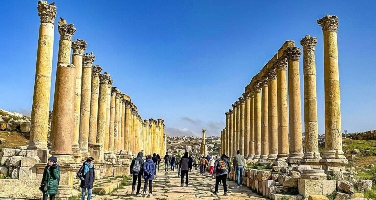
Jerash, ancient Gerasa, is one of the best-preserved Roman provincial cities anywhere. You walk in through Hadrian’s Arch, past the hippodrome, into an oval plaza ringed with columns, and up a colonnaded street still paved with the original stones, marked by the wheels of carts.
Climb to the Temple of Artemis, where the tall columns still stand, and to the South Theatre, where the acoustics carry a whisper from the stage to the top row. Allow at least three hours, and come in spring when the hills around are green.
See tours here →Open the Northern Jordan map →↑ Back to the map
Ajloun Castle
On a hilltop above the Jordan Valley stands Ajloun Castle, built in the 12th century by a commander of Saladin to watch over the iron mines and the roads, and later enlarged by the Mamluks.
Walk through its towers and dark halls, then climb to the top. On a clear day the view stretches over the valley towards Palestine. The pine and oak forests around it are some of the greenest places in Jordan.
See tours here →Open the Northern Jordan map →↑ Back to the map
Umm Qais (Gadara)
In the far north, on a ridge above the Yarmouk valley, lies Umm Qais, the ancient city of Gadara. Its theatre is built of black basalt, unlike anything else in Jordan, and the views take in the Sea of Galilee, the Golan Heights and the hills beyond.
Gadara was a city of poets and philosophers in Roman times. Come in the late afternoon, sit on the theatre steps, and watch the light fade over three countries.
See tours here →Open the Northern Jordan map →↑ Back to the map
Madaba
Madaba is the City of Mosaics. In the Greek Orthodox Church of St George lies the Madaba Map, a 6th-century mosaic of the Holy Land with Jerusalem at its centre, the oldest surviving map of the region.
Walk the old streets and you will find more mosaics in churches, houses and the Archaeological Park, and workshops where local craftsmen still make them by hand.
Mount Nebo
Mount Nebo is the ridge where, according to the Bible, Moses looked out over the Promised Land before he died. The memorial church on the summit protects beautiful Byzantine mosaic floors.
From the terrace the land falls away to the Jordan Valley and the Dead Sea, and on a clear day you can see Jericho and even Jerusalem. It is only twenty minutes from Madaba, so the two are easy to visit together.
Baptism Site (Bethany Beyond the Jordan)
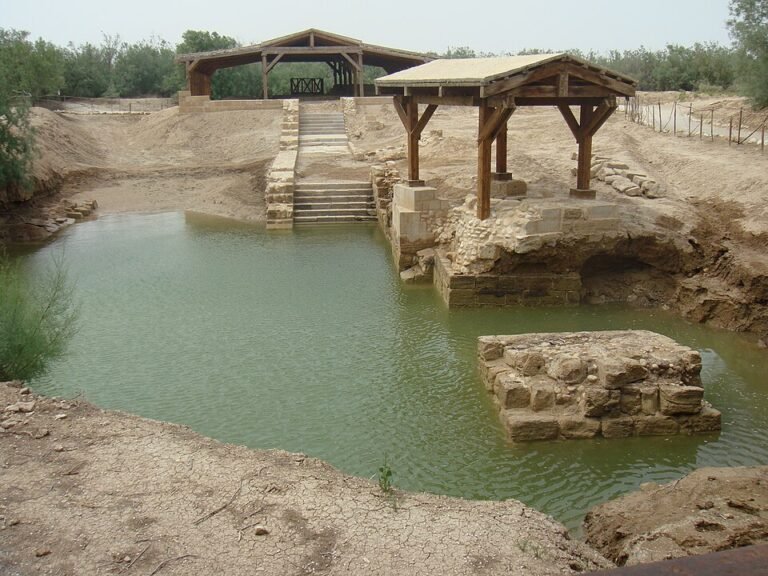
On the east bank of the Jordan River lies Al-Maghtas, Bethany Beyond the Jordan, recognised by UNESCO as the place where John baptised Jesus. A path leads through the tamarisks to the remains of Byzantine churches and baptismal pools.
At the river itself you can stand at the water’s edge, and many pilgrims renew their baptism here. It is a calm, moving place, whatever your faith.
The Dead Sea
The Dead Sea lies more than 400 metres below sea level, the lowest place on land. Its water is so salty that you float without trying, lying back as if in an armchair.
Cover yourself in the black mud, rinse off, and float again. The resorts along the shore have beaches and fresh-water showers, and the sunsets over the hills of Palestine are unforgettable. Do not shave on the day you swim, and keep the water out of your eyes.
Kerak Castle
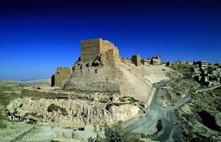
Kerak Castle sits on a ridge above the King’s Highway, a huge Crusader fortress built in the 12th century and later strengthened by Saladin’s successors and the Mamluks.
Explore the long vaulted halls and dark passages underground, and look out from the walls over the deep valleys on every side. It is a good stop on the way between Amman and Petra.
Dana Biosphere Reserve
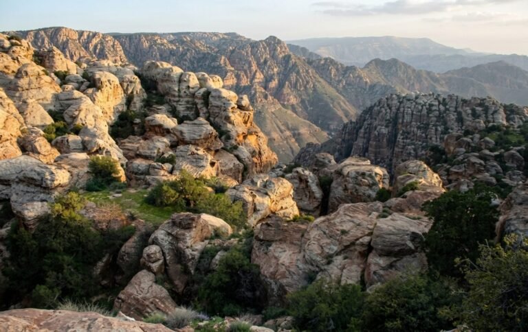
Dana is Jordan’s largest nature reserve, dropping from the stone village of Dana on the edge of the highlands down to the sands of Wadi Araba far below. In a single walk you pass through several different landscapes.
We love it for hiking: the trails, the silence, and the birds of prey overhead. Spend a night in the village or at one of the eco-lodges to see it at its best.
Shobak Castle
Shobak, called Montreal by the Crusaders, was built in 1115 on a lone hill above orchards and springs. It was the first Crusader castle east of the Jordan.
Inside you can explore chapels, halls and a long staircase cut deep into the rock. It is quieter than Kerak and only about an hour from Petra.
Petra
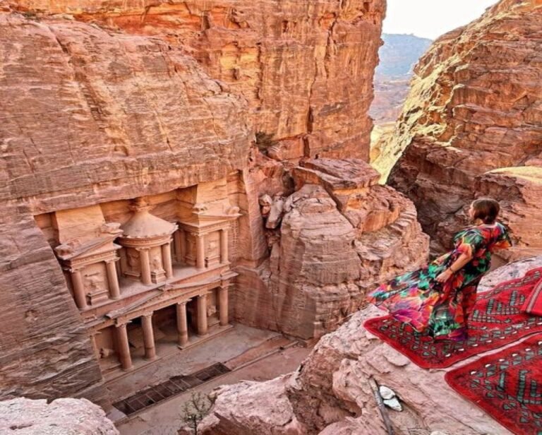
Petra, the rose-red city of the Nabataeans, was carved from the mountains more than 2,000 years ago. You enter through the Siq, a narrow gorge, and at its end the Treasury appears, the moment every visitor remembers.
Beyond it lie tombs, temples, a theatre, a colonnaded street, and the Monastery high on the mountain. Give it at least one full day, two if you can. Open our Petra map for every site, trail and ride.
Little Petra (Siq al-Barid)
A short drive north of Petra is Siq al-Barid, Little Petra, a small Nabataean suburb in a narrow canyon. Its carved houses, cisterns and staircases are far quieter than the main city.
Climb into the Painted House to see rare Nabataean paintings of vines and birds on the ceiling. Nearby are the remains of Beidha, one of the oldest farming villages in the region.
See tours here →Little Petra on the Petra map →↑ Back to the map
Wadi Rum
Wadi Rum is a desert of red sand and towering sandstone and granite mountains, home to Bedouin families for generations and a UNESCO World Heritage site.
Ride a jeep or a camel to the canyons, rock bridges and dunes, climb a sand slope at sunset, and spend the night in a Bedouin camp under more stars than you have ever seen. Open our Wadi Rum & Aqaba map for the places to visit.
See tours here →Open the Wadi Rum & Aqaba map →↑ Back to the map
Aqaba
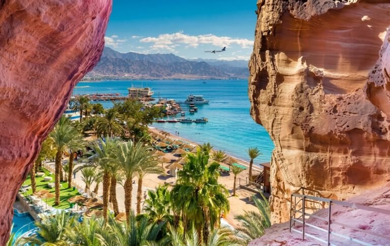
Aqaba is Jordan’s only city on the sea, on the Gulf of Aqaba. The water is warm almost all year, and coral reefs lie just off the beaches south of the city.
Snorkel or dive at the Marine Park, take a glass-bottom boat, visit the old Mamluk fort near the giant flagpole, and eat fresh fish in town. It is less than an hour from Wadi Rum.
See tours here →Open the Wadi Rum & Aqaba map →↑ Back to the map
Qasr Kharana
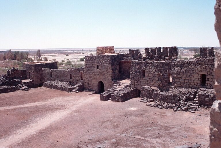
Standing alone in the open desert east of Amman, Qasr Kharana looks like a fortress, but it was probably a meeting place or inn for travellers in the early 8th century, in the time of the Umayyads.
Inside, two floors of rooms open onto a central courtyard. Climb to the upper floor and look out over the empty desert.
Qasr Amra
Qasr Amra is a small Umayyad bathhouse from the early 8th century, and a UNESCO World Heritage site. Its walls and ceilings are covered in paintings: hunting scenes, musicians, animals, and a dome painted with the signs of the zodiac.
It is among the oldest surviving examples of Islamic painting. Combine it with Qasr Kharana and Azraq on a day trip into the eastern desert.
Azraq
Azraq is an oasis in the eastern desert. Its wetland reserve is a resting place for migrating birds, and boardwalks lead through the reeds and pools.
In the town stands Qasr al-Azraq, a fort of black basalt where T. E. Lawrence spent the winter of 1917–18 during the Arab Revolt. Its heavy stone door still turns on its hinges.
Ways to see Jordan
Choose what you want to understand, not only where you want to go.
Experience Jordan Virtually
Discover Jordan’s extraordinary landscapes, ancient history and cultural heritage through immersive digital experiences. Choose a destination, follow the classic route, look around in 360°, and see which of our tours takes you there.

The Siq
From your local guide
Walk the Siq slowly. The gorge runs for about 1.2 km and keeps narrowing, and every bend hides what comes next. Our guides point out the water channels the Nabataeans cut low along both walls.
- About 1.2 km long
- Leads straight to the Treasury
The Treasury
From your local guide
Everyone expects a palace behind this façade. There is none: the Treasury is a monumental tomb carved into the cliff face, with only a modest chamber inside. For a quieter experience, consider arriving early in the morning; visitor numbers vary by day and season.
- About 40 m high
- Carved about 2,000 years ago

The Theatre
From your local guide
Unlike Roman theatres built up from blocks, this one was carved straight into the mountain. Look at the top rows: the builders cut through older tombs, and their open chambers still show above the seats.
- Carved into the mountainside
- Seats several thousand people

The Royal Tombs
From your local guide
This is where the Nabataeans buried their elite: four great façades cut side by side into the mountain. Step inside the Silk Tomb to see the sandstone’s red, white and ochre bands up close. They glow best in afternoon light.
- Urn, Silk, Corinthian and Palace Tombs
- Best in afternoon light
The High Place of Sacrifice
From your local guide
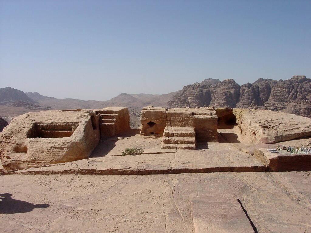
The climb is steep and stepped, but the reward is Petra’s ancient ritual platform, with altars cut into the summit and the whole city spread out below. Start early: there is little shade on the way up.
- Steep, stepped climb
- Little shade: go early
Tours that stop here
Not included in our standard itineraries. Contact us to discuss a custom visit.
Ask a local guide
Qasr al-Bint
From your local guide
Most of Petra was carved out of the rock, but Qasr al-Bint was built: it is the city’s great free-standing temple, still standing to its full height. Electric carts run here from the Treasury, and the trail up to the Monastery starts close by.
- Petra’s main free-standing temple
- Electric cart from the Treasury: 2 km
The Monastery
From your local guide
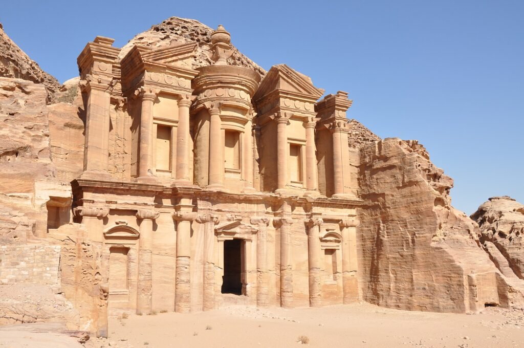
Save your energy for this one. 873 rock-cut steps lead up to Ad Deir, a façade even larger than the Treasury. Go in the late afternoon, when the steps are in shade and the stone turns gold.
- 873 rock-cut steps
- Best in late afternoon

Jabal Haroun
From your local guide
The white-domed shrine on the summit marks the traditional tomb of Aaron, brother of Moses, and is still a place of pilgrimage. The trail is long and remote, so go with a local guide and plenty of water. The views over Wadi Araba are unforgettable.
- Traditional tomb of Aaron
- Long hike: plan most of a day
Tours that stop here
Not included in our standard itineraries. Contact us to discuss a custom visit.
Ask a local guide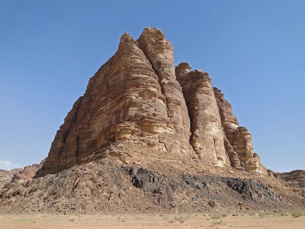
Seven Pillars of Wisdom
From your local guide
Every jeep tour starts at the Visitor Centre, right by the rock face named the Seven Pillars of Wisdom after T. E. Lawrence’s book. It is a good place to get your bearings before you head into the protected area.
- Next to the Visitor Centre
- Named after Lawrence’s book

Lawrence’s Spring
From your local guide
A short scramble up the rocks leads to a spring that, by local tradition, Lawrence used during the Arab Revolt. Even if you stay below, the view across the valley is worth the stop.
- Short scramble up
- Linked to the Arab Revolt

Khazali Canyon
From your local guide
Step into this narrow, shaded cleft in the mountain to find ancient inscriptions and rock drawings of people and animals cut into the walls. It stays cool even in the midday heat.
- Ancient rock inscriptions
- Cool and shaded
The Red Sand Dune
From your local guide
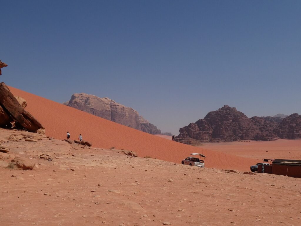
Kick off your shoes and climb the red sand dune. It is harder than it looks, but the view from the top across the valley is one of the best in Wadi Rum.
- Barefoot climb
- Wide views from the top
Tours that stop here
Not included in our standard itineraries. Contact us to discuss a custom visit.
Ask a local guide
Um Fruth Rock Bridge
From your local guide
A small natural rock arch you can climb in a few minutes with a little scrambling. It is a favourite photo stop: one person stands on top while the group takes the picture from below.
- Natural rock arch
- Easy scramble to the top
Tours that stop here
Not included in our standard itineraries. Contact us to discuss a custom visit.
Ask a local guide
Burdah Rock Bridge
From your local guide
One of the highest natural rock bridges in the area, perched far above the desert floor. Reaching it is a real scramble, so it is only for fit hikers with a local guide. The 360° view shows the desert near Burdah.
- Guided scramble only
- Allow 2–3 hours
Tours that stop here
Not included in our standard itineraries. Contact us to discuss a custom visit.
Ask a local guide
Sunset in the Desert
From your local guide
End the day the Bedouin way: watching the sun go down behind the sandstone mountains, often with tea brewed over a fire. Stay the night and the stars come out over a desert with almost no light pollution.
- Sunset over the mountains
- Stay overnight under the stars

Hadrian’s Arch
From your local guide
Jerash welcomes you the way it welcomed Emperor Hadrian: the city built this triumphal arch for his visit in the winter of AD 129–130. The 360° view starts on the road outside, so you see the arch as travellers do on arrival.
- Built for Hadrian’s visit, AD 129–130
- Near the entrance
The Hippodrome
From your local guide
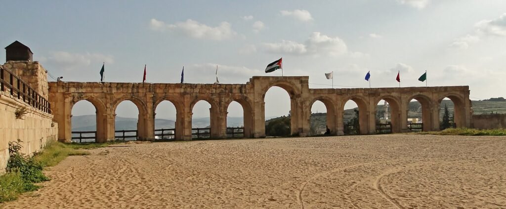
Roman Gerasa raced chariots here. The arena is about 245 m long and once seated around 15,000 spectators. Walk the track and picture the noise.
- About 245 m long
- Seated about 15,000

The Oval Plaza
From your local guide
Most visitors stop in their tracks here: a stone-paved plaza ringed by Ionic columns, unusual in the Roman world because of its oval shape. It links the main street to the Temple of Zeus on the hill above.
- Ringed by 56 Ionic columns
- Rare oval shape

The South Theatre
From your local guide
Built in the late 1st century AD, the South Theatre still seats about 3,000 people. Stand in the centre of the stage and speak normally: the acoustics carry your voice to the top rows.
- Seats about 3,000
- Try the acoustics
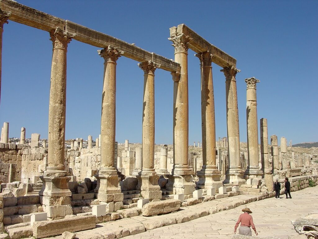
The Cardo
From your local guide
The colonnaded main street runs about 800 m through the city. Look down: chariot wheels cut ruts into the original paving stones, and the old drains still run beneath them.
- About 800 m long
- Chariot ruts in the paving
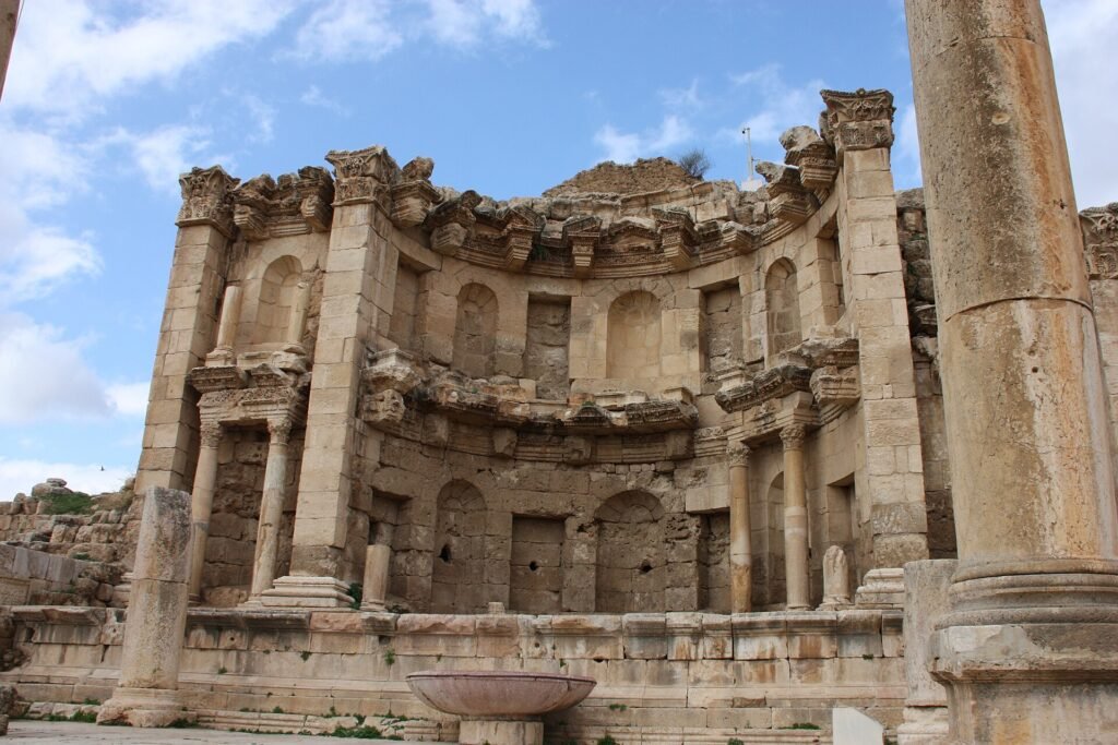
The Nymphaeum
From your local guide
This ornate two-storey fountain was dedicated to the nymphs in AD 191. Water once poured through carved lion heads into the basin at street level.
- Dedicated in AD 191
- Two storeys high

The Temple of Artemis
From your local guide
The great temple of Artemis, patron goddess of the city, still has its tall Corinthian columns standing. Ask your guide to show you how one of them moves slightly in the wind.
- Patron goddess of Gerasa
- Built in the 2nd century AD

Madaba Mosaic Map
From your local guide
The floor of St George’s Church in Madaba holds the oldest surviving map of the Holy Land, a 6th-century mosaic showing Jerusalem, the Jordan River and the Dead Sea. The 360° view starts inside the church; the map is on the floor near the front.
- Made in the 6th century AD
- Oldest surviving map of the Holy Land

Mount Nebo
From your local guide
According to the Bible, Moses looked out over the Promised Land from this ridge. On a clear day you can see the Dead Sea and the Jordan Valley below. The Memorial Church of Moses shelters beautiful Byzantine floor mosaics.
- Views over the Jordan Valley
- Byzantine mosaics in the church

The Baptism Site
From your local guide
Bethany beyond the Jordan is where many believe John baptised Jesus. A shaded path through tamarisk trees leads past the remains of Byzantine churches and baptism pools to the Jordan River itself.
- UNESCO World Heritage Site
- Remains of Byzantine churches

The Dead Sea
From your local guide
End the day floating in the Dead Sea, the lowest point on land at about 430 m below sea level. The water is so salty that you float without trying. Keep it out of your eyes and rinse off in the fresh-water showers afterwards.
- About 430 m below sea level
- You float without trying

The Citadel & Temple of Hercules
From your local guide
Begin on the Citadel hill, one of the oldest inhabited places in the city. The tall columns belong to the Roman Temple of Hercules, and next to them lies a giant stone hand, all that remains of a huge statue.
- Roman temple, 2nd century AD
- Views over downtown Amman
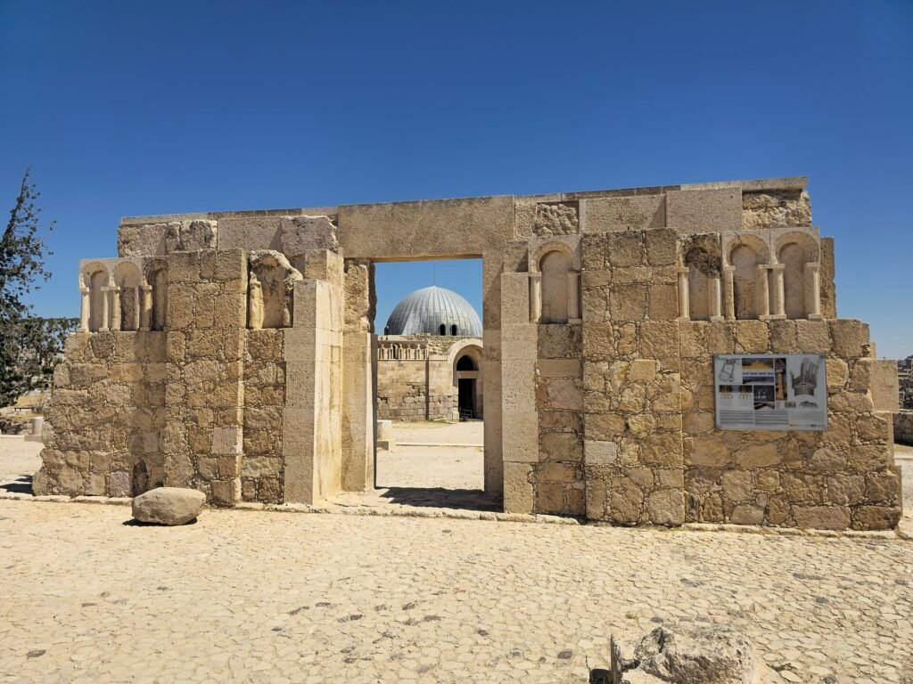
The Umayyad Palace
From your local guide
At the north end of the Citadel stands the domed entrance hall of an 8th-century Umayyad palace. Step inside to look up at the restored dome, then walk on to the large round cistern that once stored the palace’s water.
- Built in the 8th century AD
- Restored domed hall

The Roman Theatre
From your local guide
Cut into the hillside in the 2nd century AD, the theatre seats about 6,000 people and is still used for concerts. Climb to the top rows for the best view over downtown.
- Seats about 6,000
- Still used for events

Downtown (Al-Balad)
From your local guide
Wander the old downtown: spice shops, the gold souq, falafel stands and the Grand Husseini Mosque, where the 360° view starts. This is where our walking tours stop for street food.
- Street food and souqs
- Grand Husseini Mosque
Tours that stop here
Not included in our standard itineraries. Contact us to discuss a custom visit.
Ask a local guide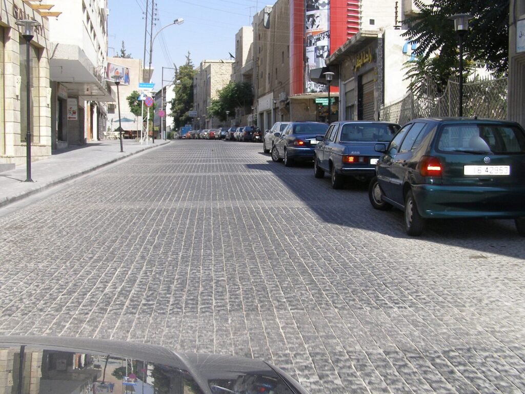
Rainbow Street
From your local guide
Rainbow Street in Jabal Amman is lined with cafés, small shops and rooftop terraces. Come in the evening, when the street fills with people and the city lights come on.
- Cafés and rooftop views
- Best in the evening

King Abdullah I Mosque
From your local guide
Its blue mosaic dome is one of the landmarks of the Amman skyline. Visitors are welcome outside prayer times; dress modestly, and robes are available at the entrance. On Fridays, call ahead before you visit.
- Blue mosaic dome
- Open to visitors outside prayer times
Tours that stop here
Not included in our standard itineraries. Contact us to discuss a custom visit.
Ask a local guide
Wadi Mujib Siq Trail
From your local guide
Wade and swim up a narrow sandstone gorge to a waterfall. The Siq Trail is wet from start to finish, so wear shoes that can get soaked; life jackets are provided. The 360° view shows the trail entrance on the Dead Sea road.
- Open about April to October
- Expect to get wet
Tours that stop here
Not included in our standard itineraries. Contact us to discuss a custom visit.
Ask a local guide
Dana Village
From your local guide
Dana is an old stone village on the edge of a huge valley. Many of its houses have been restored, and the guest house terraces look straight down into the Dana Biosphere Reserve, Jordan’s largest nature reserve.
- Jordan’s largest nature reserve
- Restored stone village
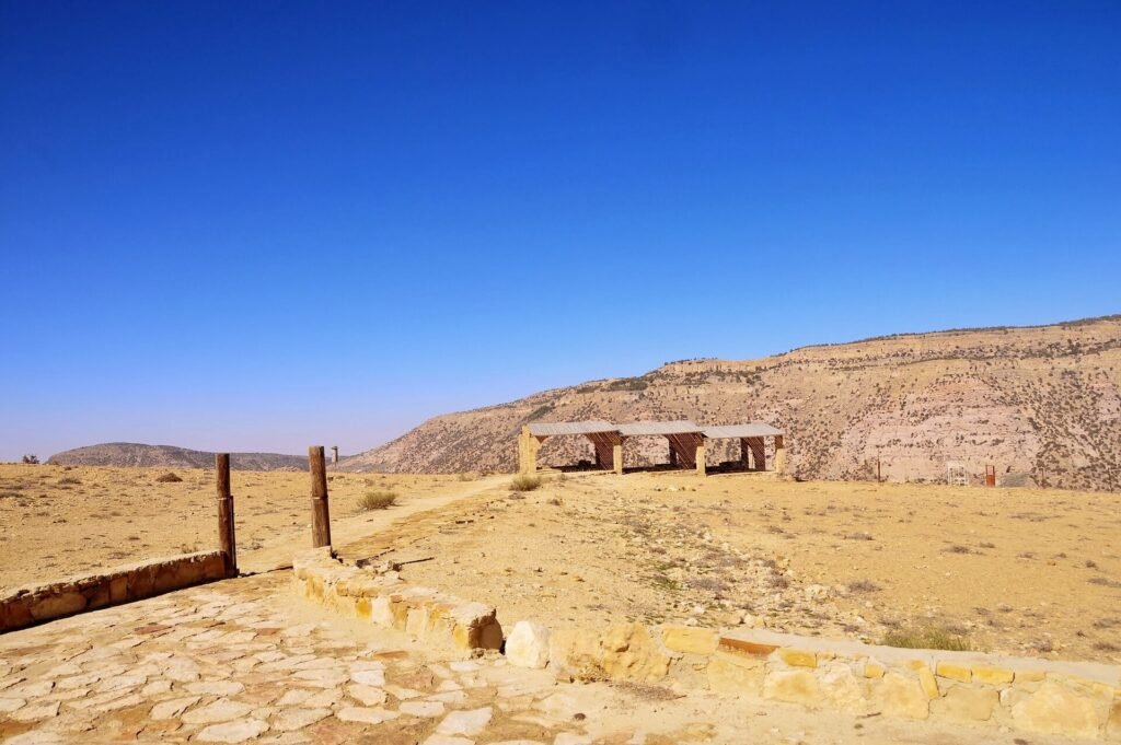
The Wadi Dana Trail
From your local guide
The trail drops about 900 m from Dana to Feynan, through red sandstone, juniper trees and finally open desert. It takes most of a day, so start early and carry plenty of water.
- About 14 km, mostly downhill
- Allow 5–7 hours

Feynan Ecolodge
From your local guide
At the bottom of the valley, Feynan Ecolodge runs on solar power and is lit by candles at night. Stay over to meet the local Bedouin community and watch the stars.
- Lit by candles at night
- Runs on solar power

Kerak Castle
From your local guide
Crusaders began this hilltop fortress in 1142. Explore its vaulted halls and dark passageways (a torch helps), and look out over the Dead Sea valley from the walls.
- Begun in 1142
- Bring a torch

Shobak Castle
From your local guide
King Baldwin I founded Shobak, which the Crusaders called Montreal, in 1115. It stands alone on a steep hill, and a long stairway tunnel cut into the rock leads deep beneath it.
- Founded in 1115
- Rock-cut stairway tunnel

Little Petra (Siq al-Barid)
From your local guide
Little Petra was probably a Nabataean stop for caravans on their way to Petra. It is small, quiet and free to enter, and you can see it all in about an hour.
- Free to enter
- About 1 hour to see it all

The Painted House
From your local guide
Climb the steps into a small rock-cut room to find one of the few Nabataean ceiling paintings still surviving: vines, flowers, birds and a little Eros with a bow, painted about 2,000 years ago.
- Rare Nabataean paintings
- About 2,000 years old
Coming next
Planned: virtual guided walks narrated by our guides, VR for headsets, and AR reconstructions at the sites.
Jordan on Screen
Hollywood keeps coming back to Jordan. These are some of the films shot in Petra and Wadi Rum, and how you can stand in the same places yourself.
 Petra · The Treasury
Indiana Jones and the Last Crusade 1989
The Treasury’s façade plays the entrance to the temple of the Holy Grail in the film’s finale. Only the outside was filmed here: there is no great hall inside, just a modest chamber.
- Wadi Rum
Lawrence of Arabia 1962
David Lean filmed much of his epic in Wadi Rum, the desert Lawrence himself knew from the Arab Revolt. The rock face by the Visitor Centre is named after his book.
Photo: Bernard Gagnon · CC BY-SA 3.0 - Wadi Rum & Wadi Araba
Theeb 2014
A Jordanian film shot in Wadi Rum and Wadi Araba, with mostly Bedouin non-professional actors. It was nominated for the Academy Award for Best Foreign Language Film.
Photo: anagh · CC BY-SA 3.0 - Wadi Rum
Prometheus 2012
Ridley Scott used Wadi Rum’s cliffs, dunes and ridges for the alien world LV-223.
Photo: Cadouf · CC BY-SA 4.0 - Wadi Rum
The Martian 2015
Wadi Rum’s red sand stood in for the surface of Mars. The rover from the film is now on display at the Royal Automobile Museum in Amman.
Photo: Guillaume Baviere · CC BY 2.0 - Wadi Rum
Rogue One: A Star Wars Story 2016
Wadi Rum became the desert moon Jedha.
Photo: Daniel Case · CC BY-SA 3.0 - Wadi Rum
Aladdin 2019
Disney filmed desert scenes for its live-action Aladdin among Wadi Rum’s dunes and rock formations.
Photo: Trldp · CC BY-SA 4.0 - Wadi Rum
Star Wars: The Rise of Skywalker 2019
Wadi Rum returned to Star Wars as the desert planet Pasaana.
Photo: Steffen 962 · CC BY-SA 4.0 - Wadi Rum
Dune & Dune: Part Two 2021 · 2024
Denis Villeneuve filmed key desert scenes of both films here. Wadi Rum’s dunes and sandstone cliffs became the planet Arrakis.
Photo: Steffen 962 · CC BY-SA 4.0
Photos show the locations as they are today, not scenes from the films.
Travel Jordan with local guides
Private tours with licensed local guides and drivers, planned around you.
Book your Jordan experiencePlan your journeySuggested itinerariesMap and photo credits
- Map © Jordan by Locals; map data © OpenStreetMap contributors (ODbL).
- Umm Qais: Berthold Werner, CC BY-SA 3.0, via Wikimedia Commons
- Ajloun Castle: Hiking in Jordan website and guidebook, CC BY-SA 2.0, via Wikimedia Commons
- Baptism Site: Producer (talk), CC BY 2.5, via Wikimedia Commons
- Shobak Castle: Dosseman, CC BY-SA 4.0, via Wikimedia Commons
- Qasr Amra: Daniel Case, CC BY-SA 3.0, via Wikimedia Commons
- Qasr Kharana: High Contrast, CC BY 3.0 de, via Wikimedia Commons
- Azraq: Steffen Sledz (Zone42), CC BY-SA 3.0, via Wikimedia Commons